Content can be downloaded for non-commercial purposes, such as for personal use or in educational resources.
For commercial purposes please contact the copyright holder directly.
Read more about the The Creative Archive Licence.


Description
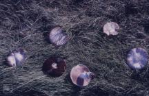
Picture: 1
St Mary's Well Bay
White Lias slabs. Cliff West of Penarth, March 1973
Date: March 1973
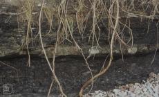
Picture: 2
Views from Penarth Head and over Cardiff Bay
Heap of crumbled shale east of Lavernock. Lower Penarth
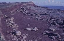
Picture: 3
Lavernock Geology cliff and beach platform shale bands and clay mud
Lias Beach, shale under sandstone surface. West of Lavernock Point. August 1978
Date: August 1978
Picture: 4
Lavernock Geology cliff and beach platform shale bands and clay mud
Bristol Channel sands below the Jurassic Cliffs of Lavernock Reserve. Lavernock Point, horizon, bedding, storm beach.
Picture: 5
St. Mary's Well Bay. Lias cliffs in East.
Outcrop on beach platform. St Mary's Well bay.

Do you have information to add to this item? Please leave a comment
Comments (0)
You must be logged in to leave a comment