Content can be downloaded for non-commercial purposes, such as for personal use or in educational resources.
For commercial purposes please contact the copyright holder directly.
Read more about the The Creative Archive Licence.


Description
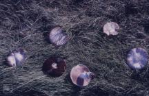
Picture: 1
Lavernock Geology cliff and beach platform shale bands and clay mud
Lavernock Point Map. Position of Nature Reserve. December 1982
Date: December 1982
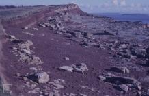
Picture: 2
Lavernock Geology cliff and beach platform shale bands and clay mud
Lavernock Point map. Scrub - spread in reserve. 1980
Date: 1980
Picture: 3
Sully Island Maps
Sully Island map of vegetation. (Peter Ferns)
Picture: 4
Sully Island Maps
Sully Island map of Rabbits. (Peter Ferns)
Picture: 5
Sully Island Maps
Sully Island map of mice and voles (Peter Ferns)
Picture: 6
Sully Island Maps
Sully Island map of uncommon mammals (Peter Ferns)

Do you have information to add to this item? Please leave a comment
Comments (0)
You must be logged in to leave a comment